By Maureen Belt
Few things are as embarrassing. You’re in the midst of a peaceful walk along one of the town’s 80-plus miles of trails and suddenly you find yourself turned around. Each tree and trail looks like the last, and the GPS on your phone (if you even get a signal) offers no guidance back to civilization.
You’re lost.
Eventually, you try your luck on different paths — any path — and it works. You see something up ahead. As you draw nearer, you discover it’s a stranger’s backyard. You could turn back, but you’ll probably end up walking in circles again. Plus it’s getting dark. So you saunter through the private property as if this was part of your original plan. If you’re lucky, no one will notice. If not, you’ll just have to apologetically explain what happened and rightfully assume you’re not their first trespasser. Either way, the solace you sought on your walk has eluded you.
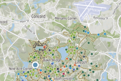
Good news — getting lost in the woods is becoming a plight of the past thanks to the folks at the Lincoln Land Conservation Trust. Earlier this year, the LLCT partnered with Outerspatial, a cloud-based platform that allows parks and recreation agencies and similar nonprofits to digitize their trails, maps, and other outdoor activities so users can access them from mobile devices.
The LLCT not only funded the map digitization of Lincoln’s trails, parklands and open spaces — its members did the heavy lifting. Stewardship Director Sara Lupkas pored over reams of data from the Assessor’s Office and tweezed out the details that were needed to populate the free, user-friendly app to help anyone navigate and enjoy Lincoln’s great outdoors.
Besides directions, photographs, and a brief history of the town’s trails and open spaces, the app tells you which trails are best for dog walkers, strollers, and wheelchairs as well cyclists and off-roading. Anglers and hunters have not been forgotten. The app even includes directions to gas stations, crosswalks and where to get a pizza.
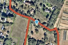
More importantly, you won’t get lost. “The app tells you exactly where you are on the trail,” Lupkas said.
The app (which is free for Apple and Android phones) only works while you’re in Lincoln or one of the other Outerspatial partners, so it won’t pinpoint your exact location if you wander into Wayland or Weston, though officials from Weston officials are currently in talks with the company. Other nearby organizations already in the network include The Nature Conservancy, Mass Audubon, The Trustees of Reservations, and several towns on Martha’s Vineyard.
“Our hope is that there is more connectivity,” said Lupkas.
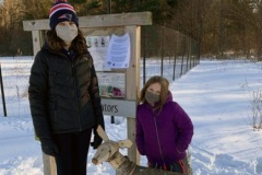
Scores of Lincolnites downloaded the app to post photos of themselves on social media during the scavenger hunt portion of February’s Winter Carnival. Lupkas said similar community events are in the pipeline.
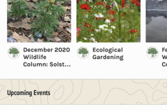
Meanwhile, the LLCT will upload articles, such as Gwyn Loud’s popular monthly wildlife column, and upcoming events.
“There are a few kinks that need to be ironed out,” Lupkas said, adding the app allows for real-time edits, which are impossible for printed maps. “But it’s been very well received.”
Click on images for larger versions and captions:


I wonder if the app. could include trails best for riding horses? Many of the trails in LIncoln were orginally cart trails and there are those of us who still ride on them. I’m hoping we will not be forgotten.
Nancy Bergen
Hi Nancy, I sent you an email about this, I’d love to follow up with you about horse trails. Thanks!
LOL. I’m sorry for all of the neighbors whose backyard I walked through! Now I won’t have to.
How do I access the app?
You can access it by this link:
https://lincolnconservation.org/outerspatial/